
Soledad Street Address Walkthrough
The cleanest street-by-street method begins with the physical address, not a guessed person's name. Monterey County's assessor web inquiry does not accept a street address or owner name as its main search route. The Parcel Report GIS is the bridge. Once the map supplies the APN, the same identifier can be carried into parcel details, a Recorder request, survey research, and a city permit request.
- Enter the known Soledad address in the official Monterey County Parcel Report and wait for the situs parcel.
- Zoom until parcel lines are clear, click the subject polygon, and record the APN, situs address, and current document reference.
- Use the APN or Assessment Number in Monterey Property Inquiry to compare status, tax-rate area, values, exemptions, and characteristics.
- Take the APN, legal description, or document reference to the Recorder's historical index or public counter for a deed and lien trail.
- Add building history, survey maps, and dated directories only when the goal is a past household or a change in the parcel over time.
The result is an address-to-record chain. It is not a roster of private occupants. That distinction keeps a Soledad street directory useful and accurate.
Soledad Street Assessor Search
Monterey County Property Inquiry is designed around parcel identifiers. Its public-facing policy says that owner-name and address searches are not available. The two primary fields are a Fee Parcel number and an Assessment Number. An APN or address/map-page utility can return property address, assessed values, exemptions, and a map page, but it still does not create a public owner-by-street list.
| Field label | Required route | Use in a Soledad street directory |
|---|---|---|
| Fee Parcel number | One parcel identifier | Opens the assessment-roll record |
| Assessment Number | Alternative identifier | Searches the same type of property record |
| APN or map-page utility | Separate address bridge | Returns address, values, exemptions, and map page |
That restriction changes the order of work. Do not treat a failed name search as evidence that no property record exists. Find the parcel first, then use the identifier the county expects. The assessor record can show ownership, parcel status, tax-rate area, values, exemptions, and physical characteristics, but ownership is not proof of occupancy.
Soledad Street Parcel Report
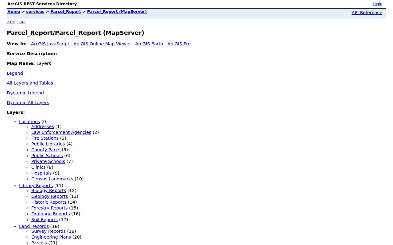
The Parcel Report service exposes more than a map pin. Its schema includes APN or ASMTNUM, current document number, a four-character land-use code, taxability, a six-character tax-rate area, land value, structure value, personal-property value, manufactured-home value, situs address, and joined physical-characteristics data.
The situs address is the physical location of the parcel. A mailing address routes tax correspondence and may point to an owner somewhere else. A legal description identifies the lot, block, subdivision, or metes-and-bounds record used by the Recorder. These fields can agree, but they answer different questions.
- Parcel
- A mapped unit of land identified by an APN or assessment key.
- Situs address
- The physical location assigned to the parcel, not a promise about who lives there.
- Plat or survey map
- A recorded map that explains lots, blocks, lines, and mapped continuity.
- Criss-cross directory
- An address-based historical directory, useful for dated household clues when a verified volume exists.
Note: GIS data refreshes and county disclaimers make a parcel card a research lead, not a title opinion.
Walk a Soledad Street in GIS
Parcel Report supports query, find, and identify actions. Search the address, zoom until the parcel lines show, click the subject polygon, and then inspect each touching or nearby polygon. The public interface did not expose a labeled buffer control, although the underlying geometry services support distance queries. Whole-street browsing therefore works by moving across visible parcels rather than by requesting a ready-made list of every address.
Adjacent polygons show spatial neighbors. They do not show all household members, and a large parcel may contain more than one structure or use. Save the APN and situs for each parcel before moving to the next. When a question shifts from the immediate block to a full named street, the broader Soledad neighbors lookup process adds block-level limits and community records.
The Parcel Report service schema shows the data fields behind a street-level parcel search.
Use the visible map for geography and the county's official record channels for legal confirmation. A street directory built from map clicks is strongest when each parcel retains its source and date.
Soledad Records Found by Address
An address-keyed record set can describe land, a building, a historical household, or a regulated registration. The table keeps those categories separate and shows the access channel supported by the research.
| Record set | Keeper | What it shows | Access |
|---|---|---|---|
| Assessment roll | Monterey Assessor | Owner, status, tax-rate area, values, exemptions, characteristics | Web by parcel identifier, counter, or data request |
| Parcel GIS | Monterey County GIS | APN, boundaries, situs, values, physical data, document reference | Free map |
| Deed or instrument | Monterey Recorder | Grantor, grantee, date, legal description, recording reference | Current counter; historical index 1850-1977 |
| Survey record | County Surveyor | Lot, block, map title, volume, page, date, image link | Free query and linked images |
| Permit history | Soledad Building | Permit number, issue date, final date, stated purpose | $58.50 written address/APN request |
| Dated directory or newspaper | Library collections | Named residents, subscribers, notices, or household clues | In-library research and microfilm |
A record can connect to the next by APN, document number, lot and block, date, or exact legal description. A street name alone is a weak join because Soledad's town grew from early Front and Main lots toward Ticino and Metz Road over time.
Soledad Mailing and Situs Addresses
A Soledad property may have a situs address in the city and a different mailing address for tax notices. A service-of-process address, license address, voter residence, and physical parcel can all differ. The clean street directory records the field name beside the value.
Mailing information can suggest that an owner is not physically at the parcel, but it does not identify the household there. A license or business filing can provide an address of record for a credential or entity. A voter registration status is tied to an authenticated person or a qualified request. Never merge those address types just because the street number looks familiar.
| Address type | Best question answered | What it cannot prove |
|---|---|---|
| Situs | Where is the mapped parcel? | Who occupies it |
| Tax mailing | Where are tax notices sent? | Where the owner lives |
| Voter residence | Where a qualified voter is registered | Everyone at that address |
| License or service address | Where a regulated record lists a person or entity | A private household connection |
Soledad Street Deed Chain
The Recorder's public historical indices cover 1850 through 1977. They are organized around indexed parties and instruments, not a modern address search. Current records are described as available through the public counter. A mail copy request should include a document number or reel and page, the recording year, at least one party's name exactly as indexed, and the document type.
Start with the current document reference from Parcel Report. Find the purchase deed, identify the seller as grantor and the buyer as grantee, then search the seller as an earlier grantee. Repeat backward while matching the legal description or APN. The historical index is a powerful address trail, but it is not a complete current street directory and an index entry is not the instrument image.
Note: Recorder copy fees are separate from recording charges; the researched copy rate is $2 per page, with $2 for certification or a document.
Soledad Permit History by Address
The City of Soledad Building Research Record form is a practical address channel when the question is how a property changed. It asks for Property Address, date, APN, lot, block, applicant name, phone, address, a separate mailing address, fax or email, and pickup or delivery choice. The result columns are permit number, date issued, date finaled, and purpose.
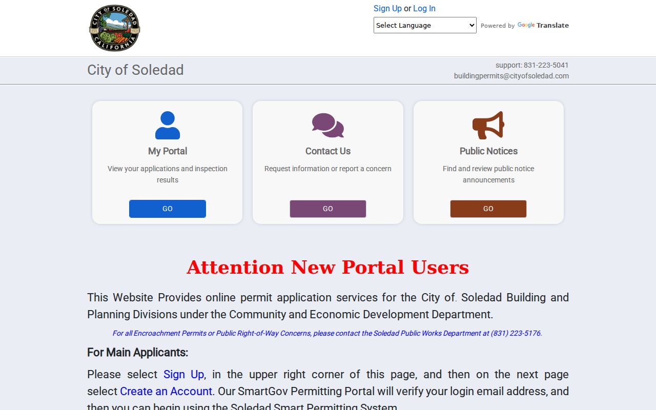
The report costs $58.50 and is completed no later than ten business days after payment. It inventories existing records, is not a site inspection, and cannot guarantee that unknown violations do not exist. SmartGov is the public building and planning portal for applicants, notices, reports, and documents. Applicant or professional details require an account, and an access code can be requested by email with a permit number. Mobile-home-park inspections are handled by state HCD at named local parks rather than by the city.
The Soledad SmartGov permit portal shows the public landing route for notices, reports, documents, and applicant access.
The Soledad Building Research Record form shows the address and APN fields used for a local permit-history request.
Soledad Street Block in 1910
The Library of Congress holds a free, three-sheet Soledad Sanborn map from September 1910. It can show building footprints, materials, uses, and block context at a fixed historical moment. Compare the Sanborn street with current parcel geometry, then use lot and block or a survey map when an old number does not line up with today's address.
Sanborn does not name every resident. The Soledad Bee, county directories, census schedules, deeds, probate files, and later permits supply names or dates around the footprint. A fire beginning at Steiner's Butcher Shop in 1915 destroyed eight downtown businesses, about half a business block. Research reconstructs that change through newspapers, maps, deeds, taxes, and permits; it does not say county deed books burned.
Note: A dated map freezes a block's physical form; it should not be read as a current occupancy list.
Soledad Survey Maps Bridge Old Streets
County Surveyor records are a hidden strength for a Soledad street directory. The survey query exposes “Find address or place,” “Survey Records Query,” Apply, and Reset controls. Result fields include Type, Volume, Page, a YYYYMMDD date, Title, coordinates, serial number, and an image or data URL. The Surveyor describes a library of tens of thousands of records reaching back to 1850.
Use a survey map when a historic address has no modern match. Catalina Munras land donations in 1873, town lots along Front and Main in 1886, the town's roughly four-block footprint by 1915, and incorporation in 1921 provide a chronology for the street grid. A lot and block can hold a stronger link across those changes than a modern street label.
Where a Soledad Street Directory Stops
No public method found in the research lists every private occupant, household member, utility customer, delivery address, or DMV address on a street. Safe at Home participants may use a substitute address and confidential voter registration. DMV data is restricted by the federal Driver's Privacy Protection Act. A parcel map can show a polygon, while a directory or newspaper may show one dated named resident. Neither is a promise about everyone present now.
Lawful personal use. Soledad address records support family history, property research, civic questions, and scam checks. Do not use a street directory to stalk, harass, intimidate, or harm anyone; verify important records with the custodian.
A street directory is strongest when it states what each source proves, preserves the date, and stops at the public-record boundary. For a person-centered question, shift to the resident lookup rather than treating a whole street as a list of names.